Nice Cote d'Azur Airport (NCE)
Driving Directions / Travel by Car
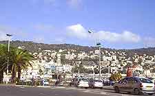
(Nice, France)
Lying about 7 km / 4 miles south-west of the city, Nice Cote d'Azur Airport (NCE) is located close to the A8 motorway and major roads RN7 and RN202. Particularly close to Nice Airport are the towns of Cagnes-sur-Mer and Saint-Laurent-du-Var, both of which lie to the west.
Nice Cote d'Azur Airport enjoys a coastal setting and is skirted by the RN7 (Promenade des Anglais) on its northern perimeter.
Directions to Nice Cote d'Azur Airport (NCE) from the north:
- Take the RN202 or the A8 motorway
- Follow the signs for the airport
Directions to Nice Cote d'Azur Airport (NCE) from the south:
- The airport is located on the south coast of the region. Therefore, there are no routes farther south of the grounds
Directions to Nice Cote d'Azur Airport (NCE) from the east:
- Access from the east is via either Promenade des Anglais or the RN7 road
- The airport is well signposted from both routes
Directions to Nice Cote d'Azur Airport (NCE) from the west:
- Access from the west is by one of three roads, the A3 motorway, the RN7, or the RN98
- The airport is signposted from each of these three separate roads
Routes to the airport have the capacity to experience congestion during peak travel times. If you are forced to make the journey to Nice Cote d'Azur Airport during rush hours, make sure to allow plenty of time for potential hold-ups.
Nice Cote d'Azur Airport (NCE): Virtual Google Maps
