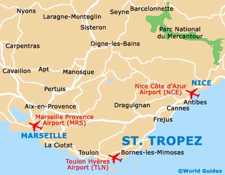
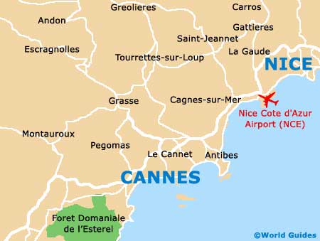
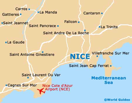
Nice Cote d'Azur Airport (NCE)
City Orientation and Maps
(Nice, France)
A particularly desirable and inviting holiday destination, Nice lies along the sunny southern coast of France and has become the fifth-biggest city in the whole of France. Nice is now the capital of the French Riviera and boasts many impressive houses and buildings.
Many people arriving in Nice choose to fly into Nice Cote d'Azur Airport (NCE), which can be found close to the south-western side of the city. The airport is connected to the city centre by a number of regular buses, which stop at the Gare SNCF and Gare Routière train stations.
Nice Cote d'Azur Airport (NCE) Maps: Important City Districts
The main tourist information outlet can be found alongside the SNCF station and is known for its helpful staff and useful 'Cote d'Azur en Fetes' magazine, which contains all the current attractions listings.
Old Town Nice is full of medieval charm and the historic buildings contrast with the more modern Italianate architecture that has emerged in recent years. Nice is simple to get around and it does not take long for you to get your bearings, with the public square of Place Masséna being located in the heart of the city and being an excellent point of reference.
Scenic mountains lie to east of the harbour and provide an appealing backdrop. Along the seafront you will find the popular Promenade des Anglais, which stretches for around 5 km / 3 miles and boasts some incredible views of the coastline.
France Map

Nice Map